Lima was founded by the Spanish Conquistador Francisco Pizarro in a fertile river valley in 1535. In 1542, it was made the capital of the Viceroyalty of Peru. Lima is the capital and largest city in Peru and the second largest in South America, behind only Sao Paolo. This month's Map of the Month is actually an eleven-part map series of Lima, Peru. These maps, which focus on streets and topography, published in 1983, focus on the central and southern portion of the Lima Metropolitan Area, detail street plans and other central landmarks.

A central focus of the map series are the streets of the expansive city. Each map presents highly detailed and accurate street information showing individual blocks, parks and particular large and important buildings. It also details the port, railways, and freeways of the city as well as some particular land uses.

Among those land uses are parks and stadiums for recreation and entertainment. These are found dotting the maps, particularly in the western portions of the city. Several large and prominent parks and sports facilities shown on the map are Parque Campo De Marte, Parque de la Exposicion, Parque De La Reserva, and the National Stadium. All landmarks in addition to parks and sports facilities.
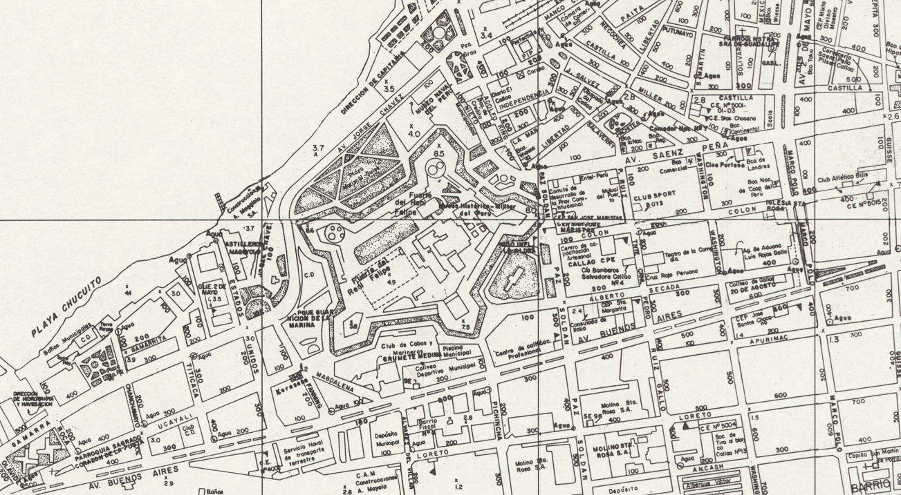
Lima is an old colonial city, filled with history and many historical buildings and monuments. One example is the Real Felipe Fortress, an 18th century fortress built on the coast of the city of Callao, now part of the Lima Metropolitan area, in its historic central area. It was built to protect the city from pirates as Callao was and remains Peru’s most important port city.
Lima’s status as the capital and economic center of Peru has led to expansive growth in the population and spatial extent of the urban region. Large numbers of migrants from within Peru itself and from abroad settled the city over the last several decades. Between 1950 and 2025, Lima’s population grew by over a magnitude of 10. Just in the few decades since the creation of this map series, the population of the Lima metropolitan area has more than doubled — from roughly 5 million in the early 1980s to over 11 million people today. Roughly a third of the population of all of Peru is concentrated in the Lima metro region.

Such large population growth naturally requires substantial growth in the city’s physical footprint. Over the course of the last century, Lima has grown to fill the entirety of the Rímac river valley from the Atlantic ocean to the foothills of the Andes. Creative solutions to the lack of space have led to the expansion of the city in a variety of interesting ways, including out to sea. Indeed, particularly in the north of the city, coastlines have been expanded by as much as 600 meters (1,969 ft.). Through the process of land reclamation, entire neighborhoods stand where there was once water.

Urban expansion has also ascended adjacent mountains. Previously untouched mountainsides are now filled with sprawling neighborhoods, most built within the last 40 years. These neighborhoods are expansive and often consist of hundreds of houses built on steep mountain slopes. In modern imagery, new switchback roads can be seen, cut into the mountainside to make way for still more expansion of urban, primarily residential, land use.

The full extent of this map series may be viewed via an interactive web map application, hosted on ASU Geodata: 1983 Lima, Peru
We hope you enjoyed our August 2025 Map of the Month!
- Title: Lima Peru
- Date: 1983
- Author/Publisher: Instituto Geografico Nacional
As with all of our Map of the Month features, if you’d like to learn more about this map series or schedule a visit to explore our maps in person, please submit a Map/Geo Service Request. We’ll be sure to get back to you within two business days, but typically sooner.
-Grace Behan, Map and GIS Assistant
Sources:
Yacher, Leon. “Peru: The 1981 Census.” Geography, vol. 72, no. 1, 1987, pp. 68–71. JSTOR, www.jstor.org/stable/40571224, https://doi.org/10.2307/40571224.
CIA. “Peru - the World Factbook.” Www.cia.gov, 2024, www.cia.gov/the-world-factbook/countries/peru/#people-and-society.
World, UNESCO. “Real Felipe Fortress of Callao - UNESCO World Heritage Centre.” Unesco.org, 2018, whc.unesco.org/en/tentativelists/6647/. Accessed 14 Aug. 2025.